Hokkaido stays comfortable while the rest of Japan turns humid, and that alone explains the traffic it gets between July and September. What the season rewards is slower than a sightseeing circuit: long daylight, thin air on the high plateaus, water cold enough to shock you awake, and evenings that need a jacket.
This guide covers what to do in Hokkaido in summer that holds up to a full day of attention — along with the constraints that decide whether you can do it at all: which trails need a registered guide in July, when the lavender is out, and why several of the island's most photographed views have a date attached to them.
This article follows a single trail through Hokkaido's wild north — one way into a far larger landscape. The Hokkaido Unleashed Digital Guide draws its mountains, coastlines, and shifting seasons into one connected reading.
Summer in Hokkaido: Climate, Timing, and What to Bring
Temperature here splits by geography, not by the calendar. The central basin around Sapporo and Asahikawa gets a run of genuinely warm days at the peak of summer, but the humidity stays low enough that shade works. Along the Pacific coast of the east — Kushiro, Nemuro, the approaches to Shiretoko — sea fog can hold the daytime high below 20°C (68°F) while Asahikawa is up in the thirties. Two places on the same island on the same afternoon can require different clothing.
So pack layers: a T-shirt is right for midday and a thin fleece for the same place at seven in the evening, or at 1,600 meters at any hour. Insects are the item visitors underestimate — black flies and mosquitoes work the forests and wetlands all summer, and long, light sleeves solve that more reliably than repellent alone.
Tsuyu, and Why Hokkaido Is Left Out of It
Hokkaido is routinely described as the part of Japan with no rainy season, and the claim is more precise than it sounds. The Japan Meteorological Agency declares the onset and end of tsuyu region by region, and its record of past onset and end dates covers twelve regions, from Okinawa up to northern Tohoku. Hokkaido is not one of them. The agency's own explanation of tsuyu gives the reason: the baiu front moves north through the season but "becomes indistinct near Hokkaido in many cases," and varies too much year to year to be treated as a season at all.
The honest version is not that it never rains here in June, but that nothing stable enough to be declared happens. The gray spell that sometimes arrives before summer gets called the Ezo-tsuyu locally — a colloquial term rather than a meteorological one, which will not appear in a forecast and whose end no one will announce.
Choosing Your Window for Hokkaido in Summer
The first half of July is the quietest stretch of the season, and it comes with a trade-off worth naming out loud: Furano's lavender does not reach its peak until the middle of the month. From late July into mid-August, Obon and the school holidays lift both visitor numbers and room rates, which concentrates traffic on Furano and Biei. That leaves a narrow overlap — roughly the middle two weeks of July — when the flowers are out and the crowds have not yet arrived. Come earlier and you trade the lavender for the quiet; come later and you get neither.
Timing within the day matters more here than elsewhere in Japan, because the distances are long enough that everyone arrives at the same hour. Furano's flower farms are close to empty at opening and full by eleven. If you are weighing an earlier trip, the island's late-spring season, from the blossoms through the first fresh greenery, runs on a much emptier calendar. And two bases beat five — driving hours between regions consume the early mornings that make the island worth visiting.
What Made the Hokkaido Summer Landscape
Almost every view in Hokkaido described as timeless has a date attached to it, usually a recent one. The island only became Hokkaido in 1869, when the Meiji government renamed Ezochi and set up the Colonization Commission to settle it. Before that, Japanese authority ran through a single point of contact: the Matsumae domain in the far south held the sole right to trade with Ezochi, and its port prospered as a stop on the Kitamaebune shipping route. Its castle town and merchant streets are still standing, the oldest built layer on the island.
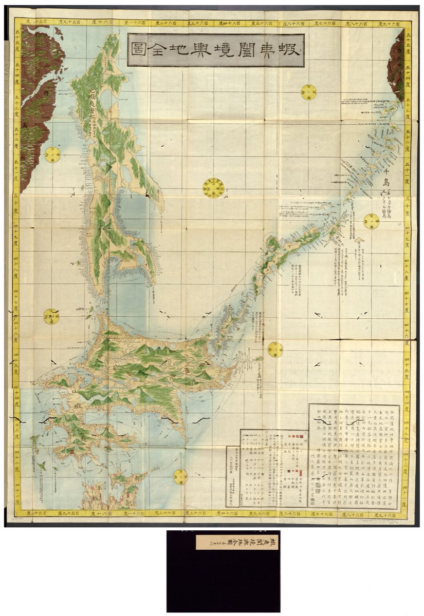
The older layer belongs to the Ainu and survives most visibly in the names. The range at the center of the island is Daisetsuzan on maps, but its Ainu name is Kamuy Mintar — the garden where the gods play. Lake, cape, and river names across Hokkaido carry Ainu originals underneath a Japanese spelling.
The Lavender Fields Are a Rescue, Not a Tradition
The purple hills above Furano look like agricultural heritage. They are the remains of a collapsed industry that one farm declined to plow under.
Lavender arrived as a perfume crop. Farm Tomita's own record of the industry dates the start to 1937, when Soda Aromatic's founder imported five kilograms of seed from France to make cosmetic raw material domestically, and Hokkaido proved to be the growing region that worked. Cultivation reached Nakafurano in 1952 and expanded. By 1970 the Furano district had more than 230 hectares under lavender, roughly 250 farms growing it, and Hokkaido's lavender oil output stood at five tons.
Then it ended, quickly. From 1972 the combination of rapid advances in synthetic fragrance and the trade liberalization that let cheap imported aromatics into the market destroyed the price. In 1973 the fragrance companies stopped buying altogether, and farmers put the land into crops that sold. In 1976 a Japanese National Railways calendar carried a photograph of Farm Tomita's field, and visitors began arriving to look at a flower that no longer had a buyer. That is the entire reason the view exists, and it turns a postcard into the last piece of something.
The Blue Pond Is Infrastructure
The Shirogane Blue Pond near Biei appears on more Hokkaido itineraries than any other single spot, usually described as a natural wonder. It is a reservoir. The Tokachidake Geopark explains that concrete check dams were built on the Biei River to protect the area from volcanic mudflows, and the pond is water that pooled behind one of them.
The color is real, and the explanation beats the mystery. Water draining off Mount Tokachi carries aluminum silicate in particles measured in ten-thousandths to millionths of a millimeter. Particles that size absorb red light and scatter blue, which is why the pond reads as that milky turquoise and why it shifts with the weather and the season's runoff.
Hokkaido Nature on Foot: Daisetsuzan, Niseko, and Shiretoko
The mountains carry the strongest argument for the wellness framing attached to this island, partly because the effect has been measured. The Ministry of the Environment's summary of research on national parks and health reports the stress hormone cortisol running about 13 percent lower in forest settings than urban ones, and parasympathetic nervous activity rising to roughly 1.5 times its urban level, both as cited by the Forestry Agency in 2010. The number worth planning around comes from MaryCarol Hunter's research at the University of Michigan: twenty to thirty minutes is the duration that most effectively lowers cortisol. Twenty minutes is smaller than the assumption, which means a real forest interval fits inside a driving day and the walk does not have to reach a summit to do anything.
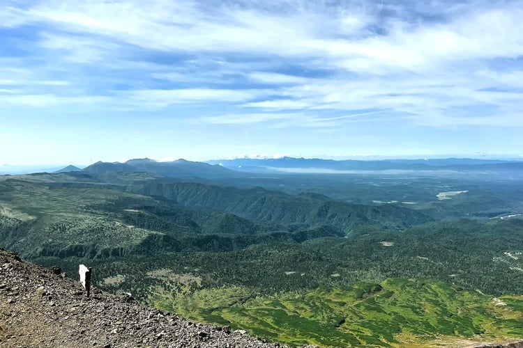
Daisetsuzan National Park was designated on 4 December 1934 and covers 226,764 hectares, according to the Ministry of the Environment's park record — a single protected block larger than several Japanese prefectures, and the reason the interior of the island stays empty. The accessible entrance is the Asahidake Ropeway, which lifts you to Sugatami at about 1,600 meters. A maintained path runs roughly fifteen minutes each way to a lookout beneath Asahidake, at 2,291 meters the highest peak in Hokkaido, and a loop circles the ponds — Sugatami-no-ike and Meoto-ike, the Couple's Pond, among them. Fumaroles vent steam audibly along the way — the most direct reminder available that this is an active volcanic range and not a park. Weather at this altitude turns without warning, so rain gear belongs in the day pack — and Asahidake Onsen sits at the base of the ropeway for afterward.
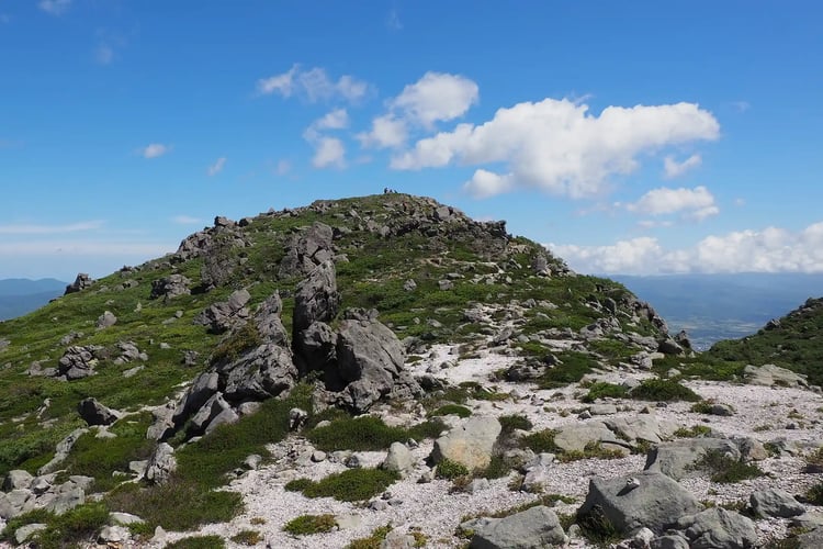
Niseko's trails are gentler and better suited to a first day. The standout is Shinsen-numa, a marshland pond below Mount Niseko-Annupuri: the boardwalk circuit runs about two kilometers, is close to flat, and takes roughly an hour round trip. Sneakers are adequate in dry weather and a poor idea the day after rain. Niseko sits on spring water and hot springs, which makes the obvious sequence — walk, then soak — easy to arrange.
Shiretoko, and the Rule Most Itineraries Miss
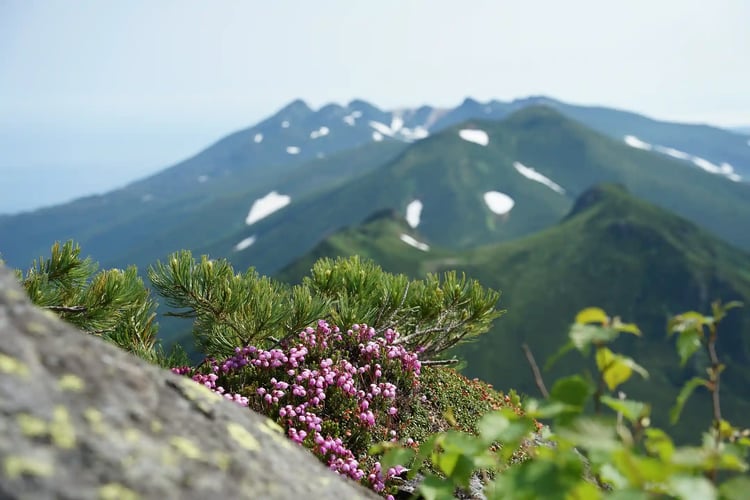
The Shiretoko World Natural Heritage area is brown bear country — Ezo higuma, the Hokkaido brown bear — in a way that has formal consequences. The Shiretoko Five Lakes run on an access system that summer itineraries tend to discover on arrival: the ground trail is not always open to independent walkers, and the period when it is closed to them covers the whole of July.
| Period | Ground trail access | Cost |
|---|---|---|
| Brown bear activity period: 10 May – 31 July | Entry only on a tour led by a registered guide | Booked ahead, large loop from ¥6,000 adult / ¥3,000 child; small loop ¥4,000 / ¥2,500. Same-day, large loop ¥7,000 / ¥3,500 |
| Vegetation protection period: opening – 9 May, 1 August – close | Free walking after a lecture of about ten minutes | ¥450 adult (12 and over) / ¥200 child (0–11) |
| Elevated boardwalk, all season | Open, no application and no lecture | Free |
Read the top row against your own dates. A July visit means the ground trail requires a tour led by a registered guide, booked in advance, per the Shiretoko Five Lakes ground pathway rules. The bear period ends on 31 July, so an August trip — Obon included — needs only the ten-minute lecture. The elevated boardwalk stays open and free throughout, runs about 1.6 kilometers round trip, is protected by electric fencing, and takes wheelchairs and strollers. It is the right answer for a family or a short stop, and not a consolation prize.
The requirement is also the best thing about the place. A registered guide reads the ground — fresh scat, tracks, what the bears have been eating that week — and turns a walk into an explanation. Across the island, small-group nature-guide tours are how the restricted parts of Hokkaido open up at all. Wherever you walk in the east, carry a bear bell, talk while you move, and if you meet wildlife, watch from where you are.
Hokkaido Summer Activities on the Water: Shikotsu, Toya, and Akan
The caldera lakes are where this season slows down properly. Shikotsu is among the clearest lakes in Japan — clear enough that the bottom stays visible under a paddleboard — and the windless hour after dawn on Shikotsu or Toya is when the guided sessions run.
Sauna, Cold Water, and the Avanto Plunge
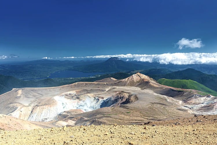
If there is a single Hokkaido summer activity people fly back for, it is the lakeside sauna, and the cold plunge is the reason. A tent or cabin sauna on the shore, then straight into lake water that stays genuinely cold through August — the Finnish word avanto has attached itself to the practice here. Reservation-only private setups operate around Shikotsu and Akan.
Lake Akan holds the strangest organism in Japanese freshwater. Marimo — spherical colonies of green algae — were designated a national natural monument in 1921 and a special natural monument in 1952, and Kushiro City's account of their global value makes the specific claim that Lake Akan is the only place in the world where marimo form large spherical colonies. The biggest exceed thirty centimeters across, growing and collapsing on cycles of five to nine years. On the same shore, Akanko Ainu Kotan is described by its own community as one of Hokkaido's foremost kotan — a settlement where Ainu people live and work rather than a reconstruction, with an indoor theater dedicated to Ainu performance. Going in the evening, after the day traffic has gone, respects what it is.
After dark the lakeshores have almost no artificial light, and the Milky Way comes up doubled in the water.
Where to Go in Hokkaido in Summer: The Shakotan Coast
The Shakotan Peninsula pushes about thirty kilometers into the Sea of Japan on a wall of cliffs, and the sapphire tone the water takes here — Shakotan Blue — is why it gets photographed. Cape Kamui has a cliff-top walkway of about twenty minutes to the tip, ending roughly eighty meters above the water with the blue running to the horizon.
%2c%20Bikuni%20Town.webp?width=750&height=500&name=Cape%20%C5%8Cgon%20(Ogon%20Misaki)%2c%20Bikuni%20Town.webp)
What makes this coastline unusual is how much industrial architecture is still lying on it. Shakotan developed as one of Hokkaido's great herring grounds, and the Hokkaido Heritage record for the peninsula and Cape Kamui lists what remains: bannya fishermen's lodges, the sites of the landing stages, fukuroma — inlets walled with stone to hold the boats — along with tunnels and stretches of the old road. The herring stopped coming. This is not untouched coast but the quiet after an industry.
Glass-bottom boats and sea kayaks are the way to see the Shakotan cliffs and coves properly. Off Shiretoko the nutrient-rich water brings whales in, and boats out of Rausu run roughly from late April to mid-October, with sperm whales alongside orcas and dolphins. Choosing an operator here deserves more attention than it gets. On 23 April 2022 a tour boat sank off Shiretoko, and all twenty-six people aboard were killed or lost. The Cabinet Office's traffic safety white paper sets out the regulatory response, which included making improved life rafts mandatory equipment and pushing operators to fit them early, and removing mobile phones from the list of equipment that satisfies the statutory radio requirement.
That gives you two concrete questions to ask before booking, instead of a general feeling about safety: what the vessel carries for a life raft, and what it uses to reach shore that is not a phone. A well-run operator answers both without hesitating, and the answer tells you more than the photographs on the booking page.
Flower Country: Furano, Biei, and Tokachi
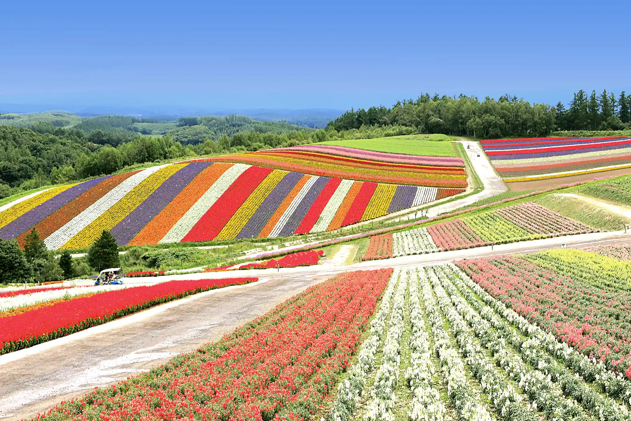
Furano's lavender generally peaks from the middle to the end of July, the one immovable date in a Hokkaido summer itinerary. Around it the hills go purple and the scent carries a surprising distance across the fields.
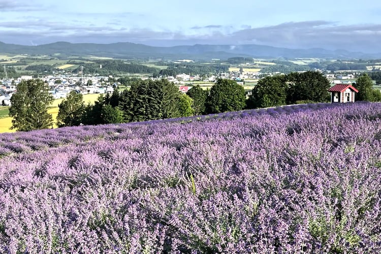
The etiquette line in most guides — stay out of the fields — reads as a formality. It is not, and Biei has a specific reason to be careful.
A poplar standing alone on a slope, known as the Philosophy Tree, was one of the most photographed objects in Hokkaido. Its owner cut it down on 24 February 2016. As ITmedia reported at the time, the tree was reaching the end of its life and had weakened considerably, and the owner had also spent years dealing with visitors who entered the farmland without permission and photographed him while he was working. In 2013 he had painted a red X on the trunk. Signs prohibiting photography did not stop it, and the decision had been made the year before he acted.
The tree is gone, and no photograph anyone took of it survives as anything but a photograph. That is the clearest available statement of what is at stake on these hills: they are working farmland, and the view is a byproduct of somebody's business, offered on trust. Stay on marked paths and outside the crop, and check drone rules in advance, since many sites now prohibit them outright.
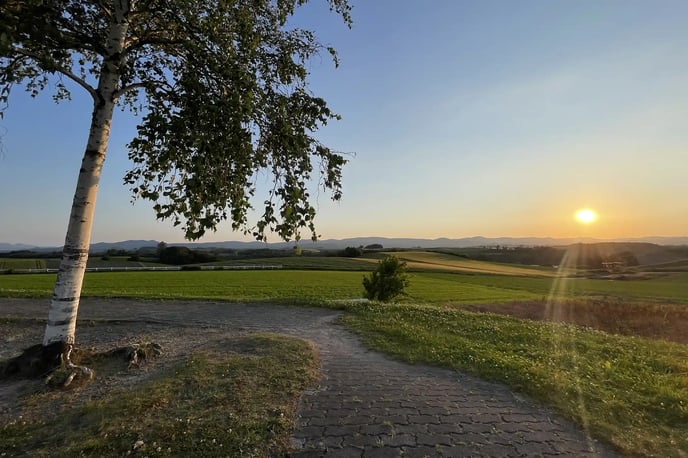
Tokachi runs guided field tours on working farms rather than visitor attractions, led by local farm guides, and depending on the week you may end up pulling potatoes or cutting sweet corn. The conversations are the point: asking a producer about the economics of organic cultivation, or what a bad season looks like, gets you further into Hokkaido than a viewpoint does. For the hills themselves an e-bike beats a car, because you can stop anywhere, which on these roads is most of the value — Zerubu-no-oka and Shin'ei-no-oka View Park string together well on one loop.
Hot Springs and Saunas in Hokkaido in Summer
Hokkaido's onsen vary unusually over short distances, and the differences are chemical rather than atmospheric — which is the logic behind toji, the old practice of going to a particular spring for its particular water. Choosing by water instead of by hotel is the difference between three similar baths and three distinct ones. Noboribetsu is the sulfur one, milky and unmistakable by smell; take off silver jewelry before you get in, because sulfur tarnishes it. Jozankei, in the hills behind Sapporo, runs clear chloride water that holds heat, so you cool down more slowly afterward, and it tastes faintly of salt.
Tokachigawa is the interesting one, and the one most often oversold. Its water is a moor spring: dark, drawn through peat, and unusual because its principal component is plant-derived humic matter, so it carries more plant material than mineral content. That composition produces the soft, slightly slippery feel marketed as beautiful-skin water. It is also regularly called one of the rarest hot springs in the world, and the Hokkaido Heritage entry for moor onsen does not support that — it states plainly that moor springs well up in various places across Japan, and that within Hokkaido they are found in Tokachi, on the Ishikari plain, and around Toyotomi. The composition is genuinely distinctive; the global scarcity is a tourism line.
If you are traveling as a couple, the reservable private bath is the single upgrade that changes the experience most — ask for the slot when you book the room, not at check-in.

Where the wilderness opens further

In Closing
The list of things to do in Hokkaido in summer that actually repays a full day is narrower than the roundups suggest, and considerably more interesting. It is twenty minutes standing still in a forest, because that is the interval the research points to. It is the first half of July instead of the second. It is a guided walk at Shiretoko because in July there is no other way onto the ground trail, and a free boardwalk when there is not time for one.
It is also a landscape with a documented history underneath it. The lavender survives because one farm refused to plow it under after the market collapsed in 1973. The blue pond is a flood-control structure. The coast at Shakotan is empty because a fishery ended. None of that diminishes the views — it gives you something to think about while standing in front of them. For how these regions connect across the seasons, the full Hokkaido itinerary guide covers the planning side.
Author Bio