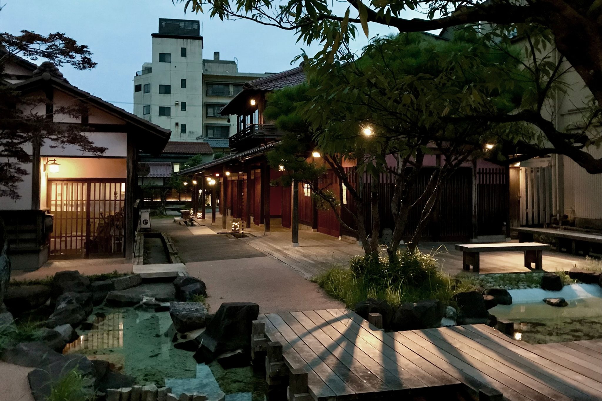
Kyoto does not have an old town. It has four of them, they total about fifteen hectares, and two of the four are places most visitors never hear of. That is the literal, checkable answer to a question the guidebooks answer with a gesture toward Higashiyama.
The gesture is not wrong. But it leaves you without the one thing that makes a walk in Kyoto legible: knowing which streets are protected, which merely look old, and why the difference shows in what you see.
This guide gives the legal answer first, then walks the four designated districts and the areas around them that feel historic without the designation. The accompanying Digital Guide sets these streets in the wider culture that produced them.
Where Kyoto Old Town Actually Is
Ask what the old town of Kyoto is called and you will get "Higashiyama," or "Gion," and both answers point at real places. Neither is a name for a defined area, which is why the question keeps getting asked—and why "where is old town Kyoto" turns up as often as it does.
Japan does have a legal category for this. Under the national system of Important Preservation Districts for Groups of Traditional Buildings, a municipality designates an area, files a preservation plan, and the national government selects it. Inside the boundary, exteriors cannot be altered freely, new construction is controlled, and repairs are subsidized. It is the strongest protection a Japanese streetscape can have.
Kyoto has four of them, and they come to about 14.9 hectares in total.
Fourteen point nine hectares. That is roughly 0.15 square kilometers, in a city of over 800. The protected historic townscape of Japan's old capital is smaller than many single city parks.
The four, with the classification each was given, are these. Kyoto's own filing with the Agency for Cultural Affairs lists them:
Sannenzaka, 8.2 hectares, a monzen-machi or temple-gate town, designated 1976. Gion Shinbashi, 1.4 hectares, a chaya-machi or teahouse quarter, also 1976. Saga Toriimoto, 2.6 hectares, another temple-gate town, 1979. Kamigamo, 2.7 hectares, a shake-machi or priests' quarter, 1988. They come to 14.9.
Kyoto got there before the country did, and the sequence is worth knowing. In 1972 the city passed what its own records call Japan's first comprehensive townscape ordinance, and designated Sannenzaka under it—at that point 5.3 hectares and around 240 households. Gion Shinbashi followed in 1974 at 1.4 hectares and around 100. Only in 1975 was the national law amended to create preservation districts at all, and Kyoto's two converted into the national system the following year. If you find a guidebook that says Sannenzaka is 5.3 hectares, it is quoting the city's 1972 boundary; the district took in the lane of Ishibe-koji in 1995 and grew to 8.2 hectares and about 280 households.
That is the useful thing about a legal boundary. It can move, and when it does, somebody had to argue for it.
Once you know the number, the experience of walking Kyoto changes in a specific way. The streets that photograph as "old Kyoto" are mostly not in it. They are ordinary streets with some old buildings on them, which is a different and in some ways more interesting thing—a working city that kept some of its fabric, not a preserved quarter. The four designated districts are the places where the fabric was deliberately held.
Notice also what the numbers say about crowding. Gion Shinbashi is 1.4 hectares; Sannenzaka, the largest of the four, is 8.2. Every photograph you have seen of "Kyoto old town" was taken inside a handful of blocks, and everyone else is walking through them at the same time.
Old Town Kyoto's Two Busiest Districts: A Monzen-machi and a Teahouse Street
Sannenzaka and Gion Shinbashi were selected in the same year and sit on the same side of the city, and they are almost opposites.
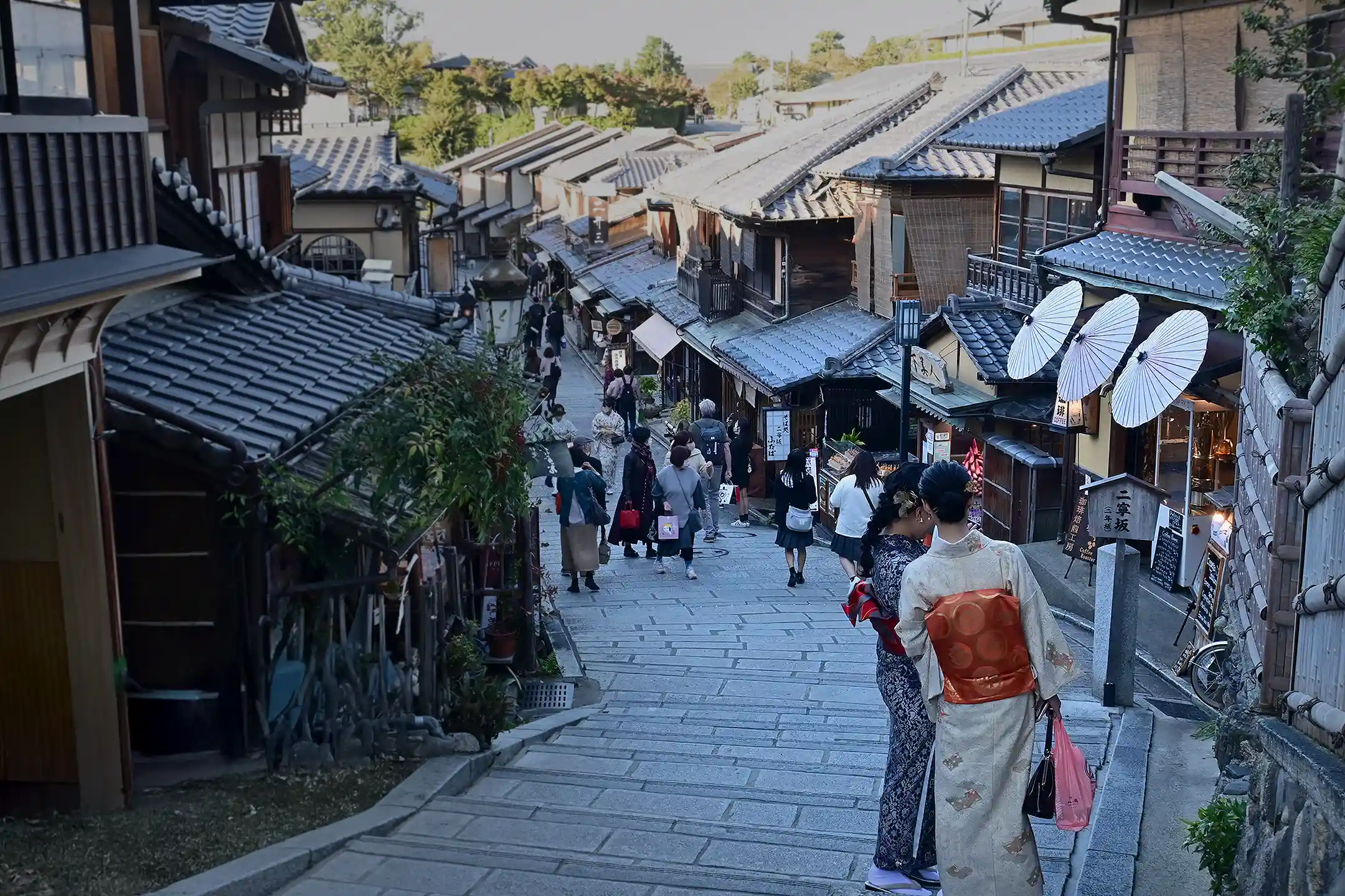
Two of the four districts are classified as temple-gate towns, and Sannenzaka is the one you will walk. The word explains the street's shape: it did not grow as a residential quarter or an entertainment district but as the approach roads to a cluster of religious sites—Kyoto's filing names Kiyomizu-dera, Hokan-ji with its pagoda, and Gion-sha, the shrine now called Yasaka. The slope, the stepped stone, the density of shops selling what a pilgrim might want all follow from that. Uphill is the direction the road was built to serve, and taking it that way puts the sequence in the order it was made in.
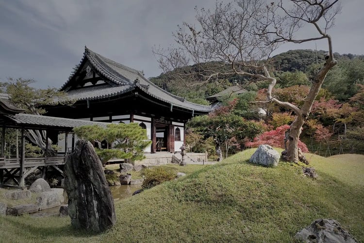
At 8.2 hectares and roughly 280 households, it is by some distance the largest of the four and the one under the most pressure. The designation controls the buildings; it does not control the number of people on the stones. Kodai-ji, pictured above, sits just off the route and absorbs almost none of them.
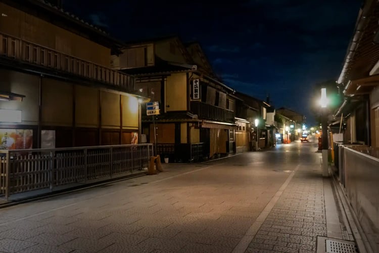
Gion Shinbashi is the other case, and its classification is different: chaya-machi, a teahouse quarter. Kyoto dates its development precisely, to 1712, when it was laid out as the teahouse street of the inner six blocks of Gion. The name Gion is older still and comes from Gion-sha, the shrine at the top of the hill. This is the 1.4 hectares along the Shirakawa canal—willows on one bank, wooden lattice fronts on the other—and it is the single most photographed stretch of the city. Its scale is the point: small enough to cross in a few minutes, which is why it reads as a complete scene rather than as a street.
Hanamikoji, the lane running south from Shijo through the neighboring blocks, is the other name you will see on signs and in captions. It is not inside the preservation district, which is a good illustration of how narrow the boundaries are—the most famous street in Gion is next to the protected part, not in it.
What both places are for is worth saying plainly, because it explains the rules. These are working hanamachi, the districts where geiko—Kyoto's word for geisha—and their apprentice maiko live, train and go to appointments. Since 2019 the residents' association has posted notices prohibiting photography in the private lanes, in English as well as Japanese, with a stated penalty. The public streets are open; the lanes off them are somebody's front path.
The practical consequence of that small scale is that both districts empty and fill sharply. They are residential and working areas, not attractions with opening hours, and the difference between 7 a.m. and 11 a.m. on the same stones is the difference between two different places. If you have one morning in Kyoto, spend it here and spend it early.
Saga Toriimoto and Kamigamo: Old Town Kyoto With Nobody In It
The other half of Kyoto's protected townscape gets a fraction of the visitors, and the reason is simply distance from Higashiyama.
Saga Toriimoto, 2.6 hectares, designated in 1979, sits at the far end of Arashiyama along the old Atago highway. It began in the late Muromachi period as a village of farming, forestry and fishing, and took on the character of a temple-gate town in the mid-Edo period—but the destination was not the temple you can see. It was Atago Shrine, high on the mountain above, and the place name means "at the torii," the shrine's first gate. Adashino Nenbutsu-ji sits at the district's midpoint, dividing an upper half of thatched farmhouses from a lower half of machiya, the tall wooden townhouses of urban Kyoto. It is roughly a kilometer and a half beyond the bamboo grove where the Arashiyama crowd turns around—about twenty minutes on foot.
Kamigamo, 2.7 hectares, designated in 1988 and the last of the four, is different again: a shake-machi, the quarter of the hereditary priestly families who served Kamigamo Shrine. The stream that runs through the shrine precinct leaves it under a new name, the Myojin-gawa, and the priests' houses stand along it, each reached by its own earth bridge across the water. Townhouses have lined it since the Muromachi period. It is residential, quiet, and almost entirely free of visitors—the only one of the four where you are unmistakably walking through somebody's neighborhood rather than along a commercial street.
The trade is straightforward. Sannenzaka and Gion Shinbashi give you the images you came for, at the cost of sharing them. Saga Toriimoto and Kamigamo give you the same legal protection and the same period of building with almost nobody in the frame, at the cost of half a day and a train or bus ride. Travelers with a week in Kyoto can have both; travelers with two days should probably not attempt it.
The Old Part of Kyoto That Was Never Designated
Most of what visitors mean by old Kyoto falls outside the four districts. These old Kyoto streets are worth walking on their own terms rather than as a lesser version of the protected ones.
Nishijin: A Working District, Not a Preserved One
Nishijin takes its name from the western encampment of the Onin War, and it had been a weaving center long before that conflict gave it the name. It has no preservation designation. What it has instead is continuity: former weavers' houses and workshops along a grid of narrow streets, and looms still running behind some of them.
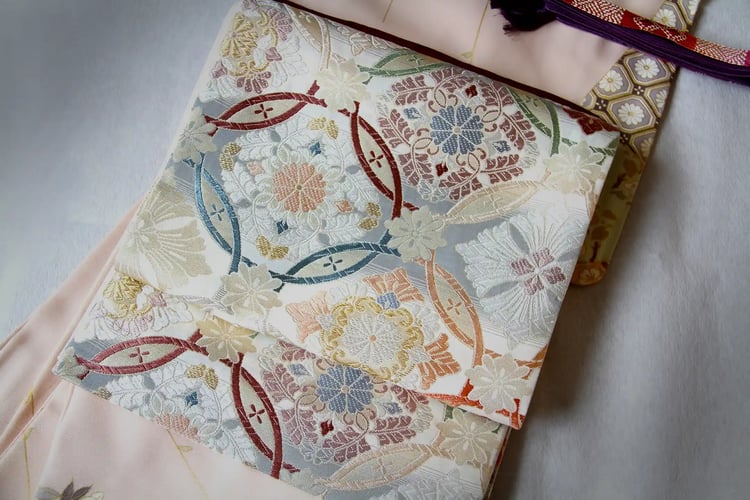
Nishijin-ori was designated a national traditional craft in 1976—the same year Sannenzaka and Gion Shinbashi entered the preservation system. Kyoto protected the streets in one place and the technique in another, in the same twelve months. In Nishijin the buildings can be replaced; what is being kept is how the cloth is made.
The obi above shows what the technique produces: pre-dyed silk threads woven into the pattern instead of printed onto finished cloth, which is why the design has depth when you turn it in the light. The Nishijin Textile Center runs demonstrations, and the walk between it and the surrounding streets is the part worth the time.
Kamishichiken: Said to Be the Oldest Hanamachi
North of Nishijin, beside Kitano Tenmangu, is Kamishichiken, said to be the oldest of Kyoto's hanamachi—the districts where geiko and maiko work. Its origins are traced to seven teahouses built from timber left over from a repair of the shrine, which is the kind of story that survives because it is a good one.
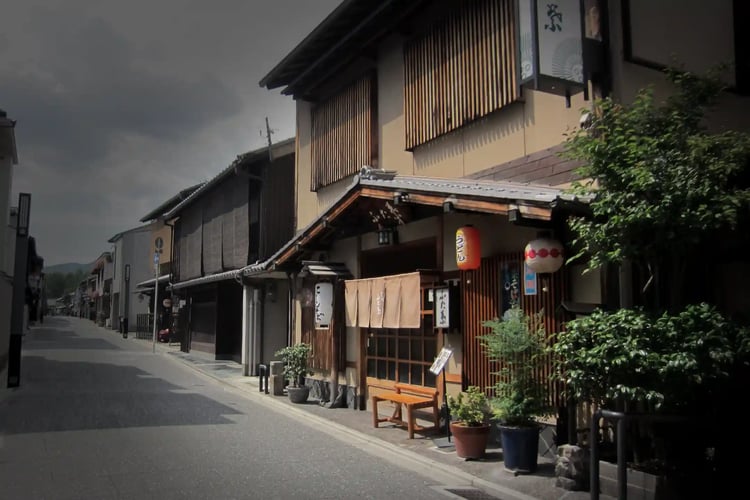
What makes it worth the detour is that it is not on the Gion circuit. The street is short, the lanterns are the same, and on an ordinary evening there is nobody photographing it. Every spring it stages the Kitano Odori, the dances its geiko perform publicly. Whether it is better than Gion depends on what you are after: Gion Shinbashi is the more beautiful stretch, and Kamishichiken is the one where you can stand still.
Nijo Castle and the Okazaki Museums: The Other Kyoto
Two more areas belong in any honest account of walking Kyoto, and neither is old town in any sense.
.webp?width=750&height=500&name=Karamon%20Gate%20of%20Nijo%20Castle%20(or%20Nijo-jo%20Castle).webp)
Nijo Castle was begun in 1603 by Tokugawa Ieyasu as the shogunate's seat in the imperial capital, and it is a UNESCO World Heritage Site. Its Ninomaru Palace is among the definitive surviving examples of shoin-zukuri, the formal reception architecture of the warrior class, and the Karamon gate above is a piece of decorative carpentry with no equivalent in the machiya districts. It is a reminder that Kyoto was governed as well as inhabited, and that the two left very different buildings.
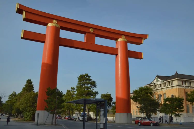
Okazaki, east of the Kamo River, is the museum district: the Kyocera Museum of Art, the National Museum of Modern Art, the great torii of Heian Jingu. It was laid out in the Meiji era around the Fourth National Industrial Exhibition of 1895, held alongside the eleven-hundredth anniversary of the capital's founding, which makes it the newest ground in this article by a thousand years. It is hard not to read the width of the streets there as a legacy of that. For temple walking proper, our guide to Kyoto's temples covers the routes in more detail.
Walking Old Town Kyoto: Order, Timing and What to Book
Four designated districts and three undesignated areas do not make a single walk. They make three, and choosing between them is the actual planning decision.
The Higashiyama morning. Sannenzaka and Gion Shinbashi, starting before eight. Uphill toward Kiyomizu-dera first, following the road's original direction, then down and north to the Shirakawa canal. Three hours at a slow pace, and the whole thing is unrecognizable after ten in the morning.
The Nishijin and Kamishichiken afternoon. West side, weaving district, then north to Kitano Tenmangu and the teahouse street. Half a day, almost no crowds, and it pairs naturally with a tea ceremony—our guide to booking a tea ceremony in Kyoto covers what to expect and how far ahead to arrange it.
The outlying districts. Saga Toriimoto in the Arashiyama direction, Kamigamo to the north. These are separate half-days and they do not combine with each other.
Two practical notes that apply to all of them. The designated districts are residential, and the preservation rules that keep the facades intact do not turn the houses into exhibits—people live behind those lattices, and Gion in particular has posted restrictions on photography in its private lanes. Read the signs; they are in English.
And book meals before you book walks. The districts are open at any hour and cost nothing to enter, while the restaurants worth eating in around them fill weeks ahead. Our guide to Kyoto's food and how to approach it covers what to reserve and when.

Continue, in a fuller landscape

Conclusion: What to Walk, and in What Order
The useful fact about Kyoto old town is its size. Four districts, about 14.9 hectares, in a city of more than 800 square kilometers.
Two of them—Sannenzaka at 8.2 hectares and Gion Shinbashi at 1.4, both designated in 1976—carry nearly all of the visitors, and they are worth the crowd if you go early enough to avoid most of it. Sannenzaka is a temple-gate town, so walk it uphill, the direction the road was built to serve. Saga Toriimoto and Kamigamo hold the same protection and almost none of the traffic, and cost a half-day each to reach.
Everything else—Nishijin, Kamishichiken, the streets around Nijo—is a working city that kept some of its fabric rather than a quarter that was set aside. Knowing which is which is what turns a walk through Kyoto into something you can read.

.webp)