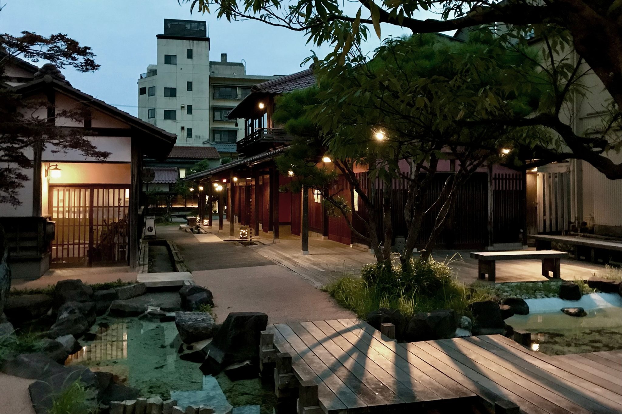
![[Complete Guide] Diverse Culture and Tradition Revealed Through Japan’s History and Administrative Divisions](https://blog.bespoke-discovery.com/hubfs/BlogArticles/21_Diverse%20Culture%20and%20Tradition%20Revealed%20Through%20Japan%E2%80%99s%20History%20and%20Administrative%20Divisions/Ishikawa%20Prefecture%20Kutani%20Ware.webp)
Japan's administrative divisions look simple from a distance: 47 prefectures, and below them the cities, towns and villages where people vote, pay tax and register their families. Look closer and the ladder has more rungs than the map admits. There are two kinds of ward that share one English word and almost nothing else. There is a layer of ancient provinces that stopped governing centuries ago and still names railway lines and prefectural offices. And there is a municipal map that has been redrawn in three great waves since 1888, taking Japan from 71,314 towns and villages to 1,718.
This guide follows those layers from the bottom of today's system back to the seventh century and forward again, with the aim of a traveler who wants to read a place name correctly: what a ward office can decide, why an old province is often the better guide to a region than the prefecture around it, and what disappeared when the villages merged.
What follows is one way into a much wider landscape. The Japan's Cities Unveiled Digital Guide gathers history, art, and the texture of refined living across Japan's cities into a single, connected reading.
Japan Administrative Divisions: The Ladder From Prefecture to Ward
Japan's local government has two tiers. The upper tier is the prefecture, and the country has 47 of them; why one is a to, one a do, two are fu and the rest are ken is a separate story, told in our guide to what a prefecture in Japan is. This article is about everything underneath, and about the older lines drawn before any prefecture existed.
How Is Japan Divided? Two Tiers and Four Kinds of Municipality
Below the prefecture sit the municipalities. The Ministry of Internal Affairs and Communications keeps a running table of their number, and its most recent line, for April 2014, reads 790 cities (shi), 745 towns (machi or chō) and 183 villages (mura or son): 1,718 in all. A footnote adds that the total becomes 1,724 if the six villages of the Northern Territories, the islands off Hokkaido that Japan claims, are counted. Japan lists them as its own municipalities; it does not administer them.
The ministry's classification of local governments then sorts the cities by size and power. A designated city (seirei shitei toshi) is chosen by cabinet order from cities of 500,000 people or more, and there are 20. A core city (chūkaku-shi) is designated at its own request from cities of 200,000 or more, and there are 62. Twenty-three more keep a special-case status that was abolished for new applicants on 1 April 2015. Everything else is an ordinary city, for which the threshold starts at 50,000 residents. Towns and villages sit below that, and Tokyo's 23 special wards sit off to one side as a category of their own.
The four kinds of municipality are therefore city, town, village and special ward, and the city itself comes in four grades. The grade decides how much of the prefecture's work a city takes over. For a designated city, the ministry notes, matters that would otherwise need the governor's approval are either freed of it or go directly to national ministers, and the city sets up wards with their own election boards. A core city receives the same exception only for welfare. An ordinary city receives none.
Two Kinds of Ward: Shibuya Elects a Mayor, Higashiyama Does Not
The single most common confusion in Japanese administrative geography is the word "ward," the usual English for ku. Tokyo has 23 of them. So do the designated cities, which are required to divide themselves into wards. Kyoto City, on the ministry's list with about 1.46 million people, has Higashiyama; Osaka has Kita; Yokohama has Naka. The word is the same. The institution is not.
Chiba City, itself a designated city, answers the question on its own frequently asked questions page. A ward in a designated city is an "administrative ward," an internal unit of city hall. Its head is a city employee appointed by the mayor, and it cannot have an assembly of its own. A special ward in Tokyo is an independent local government that functions much like a city: its head is elected by residents, and it has its own assembly.
The association of the 23 ward mayors adds the history on its overview of the special ward system, and it is not the smooth line the arrangement suggests. Tokyo's wards began in 1878, when fifteen wards were set within Tokyo-fu over roughly the old city of Edo. In 1932 Tokyo City absorbed 82 towns and villages from five surrounding districts, reorganized them into 20 new wards and reached 35. After the war the 35 were consolidated into 22 in March 1947, and Nerima split from Itabashi that August to make 23. Then, in 1952, an amendment to the Local Autonomy Act reduced the wards to internal bodies of the metropolis and abolished the direct election of ward mayors. Elected mayors returned only in 1975, and the wards were recognized in law as "basic local public bodies" from 1 April 2000.
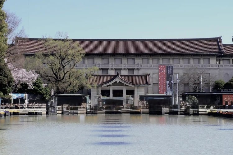
So for twenty-three years, Shibuya's mayor was not elected either. Part of the difference between Shibuya and Higashiyama is a right withdrawn in 1952 and restored in 1975. The wards are still not quite cities: the metropolis keeps some city functions across all 23, including Taitō, home of the Tokyo National Museum in Ueno, as our prefecture guide describes.
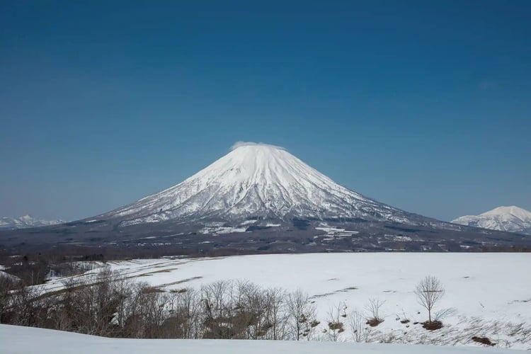
Hokkaido, under Mount Yōtei above, is the one prefecture styled do; the prefecture guide explains why.
The Ancient Provinces of Japan Stopped Governing but Never Left
Under the modern ladder lies an older one. The ritsuryō state, the centralized government modeled on Tang China's legal codes, divided the country into provinces (kuni), and each province into districts (kōri, later gun). The provinces had capitals with government offices (kokufu or kokuga), and from the eighth century each was meant to have an official Buddhist temple, a kokubunji.
%20at%20Temple%2029%20Kokubunji%20on%20the%20Shikoku%2088-temple%20Pilgrimage.webp?width=750&height=500&name=The%20Cho%20zuya%20(water%20purification%20pavilion)%20at%20Temple%2029%20Kokubunji%20on%20the%20Shikoku%2088-temple%20Pilgrimage.webp)
The water pavilion above belongs to one of them. Temple 29 on the Shikoku pilgrimage is the Kokubunji of Tosa province, in what is now Nankoku City, Kōchi Prefecture. Nankoku City's page on the temple records the imperial instruction attributed to Emperor Shōmu that a provincial temple should stand on a fine site, as "the flower of the province," and places the provincial government office, "the highest seat of government in the province," immediately to its east. The temple grounds became a national historic site in 1922. The same page adds a correction that any visitor would miss: surveys since 1987 found that three-quarters of the surviving earthen walls around the precinct are modern fill. The ancient precinct was real, and the surveys put it at 500 shaku, but most of the earthwork a visitor walks past is not it.
The temple's address is Kokubu 546, Nankoku. The neighborhood and the provincial temple share a name, nearly thirteen centuries after the temple was ordered built.
Seven Circuits That Grouped the Provinces of Japan
The provinces were grouped under a scheme later called Gokishichidō, "five home provinces and seven circuits": the capital region, and seven long bands of provinces radiating from it. The Ministry of Land, Infrastructure, Transport and Tourism names the seven as the trunk roads that linked the center to the provinces under the ritsuryō codes: Tōkaidō, Tōsandō, Hokurikudō, San'indō, San'yōdō, Nankaidō and Saikaidō. Their prototypes existed before the Taika reforms, and full construction came in the reigns of Tenji and Tenmu, around 668 to 686.
Most English readers meet the word Tōkaidō as a road, through Hiroshige's prints or the bullet train. That is half of it. The ministry's Kantō regional bureau points out, in a note on the ancient circuits, that the Kojiki and Nihon Shoki also read Tōkaidō as umitsumichi, "the sea road," and Tōsandō as yamanomichi, "the mountain road," and that each was, from a modern view, "a rather elongated administrative division." A circuit was a group of provinces strung along a route. The road and the region carried one name.
The circuits outlived the provinces they grouped. The Tōkaidō, San'yō and Hokuriku Shinkansen lines carry three of the seven names, and the JR San'in Main Line a fourth. A traveler who takes the Tōkaidō Shinkansen from Tokyo to Kyoto is riding, in name at least, an administrative region that predates the city of Kyoto itself.
The Izumo Fudoki and the Officials Without Names
In 713, the court ordered every province to report on itself: the origins of its place names, its products, the traditions of its elders. Shimane Prefecture notes that such gazetteers, called fudoki, should have been produced for all of the sixty-odd provinces of the time. Five survive, for Izumo, Hitachi, Harima, Hizen and Bungo, and only the Izumo Fudoki survives complete. Even that is known only through later hand copies. The prefecture points out why it matters: the national chronicles are written from the capital, and the Izumo Fudoki is the view from a province, full of place names still in use.
It also contains a small puzzle that is still argued over. In a December 2023 note, Hashimoto, a senior researcher at the Shimane Prefectural Center for Ancient Culture, sets it out. The Izumo Fudoki was completed in 733 and sent to the capital, and it lists each district's officials by court rank and clan name. Their personal names, which the signatures would have carried, are missing. The usual reading takes that gap as evidence that the surviving text descends from the copy kept at the Izumo provincial office rather than the one the capital received.
Hashimoto questions that inference. A tax ledger of 737 from Izumi, preserved at the Shōsōin in Nara, lists district officials without personal names too, and it is an original document that the capital formally accepted. His suggestion is that the fudoki may, like some registers, have been submitted in two copies, one signed and one not, and that ours descends from the unsigned one. He calls it a hypothesis with many hurdles left. For a reader, the value is in seeing what the provinces were: working units with their own officials and their own paperwork, some of which the law required in duplicate.
1871: Why the New Prefectures Followed the Old Provinces of Japan
By the Edo period the provinces had long since ceased to govern. Real power sat in the domains (han) of the daimyo, whose territories cut across provincial lines and were scattered with enclaves. After the Meiji Restoration of 1868, the new government dismantled them in two steps, which the National Archives of Japan lays out. Early in 1869 the lords of Chōshū, Satsuma, Hizen and Tosa petitioned to return their lands and people to the emperor, and other lords followed. On 29 August 1871, the 14th day of the seventh month in the old lunar calendar Japan still used, the edict abolishing the domains was issued, and each domain became a prefecture.
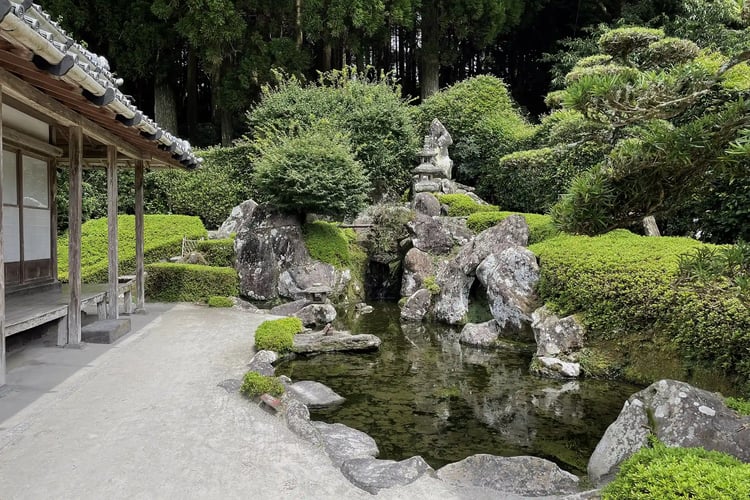
Because the domains were swapped straight for prefectures, the archives record, there were more than 300 of them, many still riddled with enclaves. They were rapidly consolidated, and by the eleventh month of the same year in the old calendar, around the turn of 1872, they had been reorganized into 72 prefectures built on "the traditional province and district as the unit." The samurai gardens of Chiran above sit in Kagoshima, the prefecture that grew out of Satsuma, one of the four domains whose lords began the process.
This is the turning point that explains most of the modern map. The new state had just abolished the domains, the most recent and most powerful layer, and when it needed a base for the replacement it reached past them to the provinces and districts, lines already more than a thousand years old. The provinces had long since stopped being the units that actually governed, and they became the scaffolding of the modern state.
France offers the contrast. As Britannica summarizes, the revolutionary government of 1790 saw the old provinces as bound up with the mismanagement of the old regime and divided them into départements of roughly equal size and population, named mostly after rivers, mountains and other features. France broke its provinces to make a modern state. Japan, eighty years later, used its provinces to build one.
Hyogo: One Prefecture, Five Old Provinces
The provinces were a base, not a template, and a later round of mergers in 1876 produced prefectures that joined several of them. Hyogo Prefecture's own account of its boundaries opens with the question directly: why, when the single province of Tosa became Kōchi Prefecture, did Hyogo end up spanning Harima, Tajima and Awaji whole, plus parts of Tanba and Settsu?
The steps are specific. When the domains were abolished in the summer of 1871, more than 30 prefectures appeared within the area of today's Hyogo. By the end of that year they had become four: Hyogo, covering five districts of western Settsu; Shikama, covering all of Harima; Toyooka, covering all of Tajima and Tango plus three districts of Tanba; and Myōdō, covering Awa and all of Awaji. In August 1876, Shikama and parts of Toyooka and Myōdō were folded into Hyogo, and the prefecture took roughly its present shape.
The prefecture's account of why is careful to present it as what is said rather than what is documented. Sakurai Tsutomu, a Tajima-born official working under the home minister Ōkubo Toshimichi, was asked for his view on merging Toyooka with Tottori. He is said to have advised joining Toyooka to Shikama instead, since Hyogo would become too large. Ōkubo is said to have told him to reconsider with the aim of strengthening Hyogo, the prefecture with the open port, and Sakurai drew up the plan that produced the modern prefecture. The border that puts the hot springs of the Sea of Japan coast and the port of Kobe in one government was, on this account, drawn to serve the port.
The provinces did not disappear inside the bigger unit. Hyogo's page on the Tajima region is published by the Tajima Prefectural Office, one of the ten regional bureaus through which the prefecture governs. Seven of the ten carry a province's name: Tajima, Tanba, Awaji, and four named for the east, north, center and west of Harima. The other three, Kobe and the two Hanshin bureaus, cover the old Settsu portion. Tajima alone covers 2,133.30 square kilometers, about a quarter of the prefecture and, in the office's words, comparable to the whole of Tokyo. Its provincial capital stood at Hidaka; in the Edo period it held the domains of Izushi, Toyooka and Muraoka and a shogunal magistrate at the Ikuno silver mine. Kinosaki Onsen, the castle ruins at Takeda and Maruyama Ōkyo's sliding-door paintings at Daijōji are all in Tajima. A visitor who plans "Hyogo" is planning five regions, and the prefecture itself still organizes them largely by province.
Administrative Divisions of Japan Below the Prefecture: Three Great Mergers
If the prefectures were settled by 1876 and have barely moved since, the municipalities are the opposite. The Ministry of Internal Affairs and Communications table on the number of municipalities and the Meiji and Shōwa mergers shows three great waves of consolidation, and for the first two it states the administrative need that drove them. Each time, the unit that a person called home was replaced by a larger one.
71,314 Villages and the School That Set the Size
In 1888 Japan had 71,314 towns and villages. The ministry describes them as the natural settlements inherited from the Edo period, and they were too small for what a modern state now asked a municipality to do: run schools, collect taxes, carry out public works, provide relief and keep family registers. A Home Ministry instruction of 13 June 1888 set a standard of roughly 300 to 500 households per town or village, and mergers followed across the country. When the City and Town-Village system took effect on 1 April 1889, Japan had 39 cities and 15,820 towns and villages, 15,859 in all. The number of municipalities fell to about one fifth in a year.
The second wave had an even more concrete yardstick. After the war, municipalities were given the new junior high schools, municipal fire services and police, and new duties in welfare and public health. The Town and Village Merger Promotion Act of 1953 set a standard of "roughly 8,000 residents" for a town or village, and the ministry explains where the number came from: it was the population judged necessary to run one new junior high school efficiently. A cabinet decision of 30 October 1953 aimed to cut the number of towns and villages to about a third. It came close. From 9,868 municipalities in October 1953, the total fell to 3,472 by June 1961.
The third wave, known as the Heisei mergers, ran through the 2000s. The same table shows 3,229 municipalities in April 1999, 2,395 in April 2005, 1,821 in March 2006, 1,727 in April 2010, and 1,718 in April 2014, where it stops. Proportionally, villages took the heaviest loss: 568 in 1999, 183 in 2014.
What was lost in each wave is the same kind of thing: a name with an office behind it. A merged village can survive as a place name inside a larger municipality, as the next example shows, but it no longer has an assembly, a head or a budget of its own. And twice the size of the new unit was set by what a municipality had to run. In 1888 that was a list of five duties, schooling among them. In 1953 it was, explicitly, one school.
What a Merger Hides: Takayama Is the Size of Tokyo
The Heisei mergers produced municipalities that are larger than a visitor expects. Takayama City's own figures record that on 1 February 2005, Takayama merged with two towns and seven villages, among them Nyūkawa, Kiyomi, Shōkawa, Kuguno, Kokufu and Kamitakara. The new city covers 2,177.61 square kilometers, about 81 kilometers east to west and 55 north to south, which makes it the largest city by area in Japan and about the size of Tokyo. Its population in the 2020 census was 84,419. Its highest point is the summit of Okuhotaka-dake at 3,190 meters; its lowest, at 436 meters, is at Kamitakara-chō Yoshino, where the name of a village that ceased to exist in 2005 lives on in the address.
For a traveler, "Takayama" is therefore two places. The old town with its merchant houses and morning markets is the Takayama of guidebooks. The city of Takayama also runs up into the Northern Alps. A ryokan that gives its address as Takayama may be a long drive from the old town, and the only way to know is to read the part of the address after the city name.
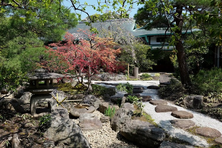
Fame and administrative rank do not travel together either. Kamakura, seat of Japan's first shogunate and home of Tsurugaoka Hachimangū above, appears on none of the ministry's lists of designated, core or special-case cities. By the ministry's classification it is an ordinary city, while Yokosuka and Hiratsuka, elsewhere in the same prefecture, both sit on those lists. The grade measures population and the services a city runs. It says nothing about history.
How to Read an Administrative Area in Japan From an Address
Using Japanese administrative divisions on a trip does not require a map of the 1,718 municipalities. It requires knowing which of three questions to ask, and each is answered by a line in this article.
The first is what kind of ward you are in. In the 23 wards of Tokyo, the ward is a government: it has its own elected mayor and assembly, and it makes its own ordinances. In Kyoto, Osaka, Yokohama or any of the other designated cities, the ward is a branch of city hall, and the decisions that matter are made at the city. The same word on a hotel address points to two different levels of government.
The second is what the municipality was before it merged. A city name on a booking tells you the government, not the place. Since the Heisei mergers, the village or town name that survives in the address, as Kamitakara does in Takayama, is often the better guide to where you will actually be.
The third is which old province you are in. Where one province became one prefecture, as Tosa became Kōchi, the question answers itself. Where a prefecture joins several, as Hyogo does, the province is largely the unit that the prefecture itself still uses to organize its regions. It is also the unit the oldest records use. The Harima Fudoki, one of the five surviving provincial gazetteers, describes a province that is now part of Hyogo; a traveler reading it is reading about Harima, not about the prefecture that absorbed it in 1876.
A regional reading of Japan's cities, rather than its boundaries, is the subject of our guide to Japan's cities, and our guide to Japan's geography and administration looks at how the land itself shaped where regional identities settled.
The fuller landscape

In Conclusion
Japan's administrative divisions are layered, and the layers do not replace one another cleanly. The provinces stopped governing centuries before 1871 and then became the base for the prefectures. The domains that actually governed were abolished outright. The villages of the Edo period were merged into larger units three times over, twice around services the state needed, and some of their names now survive only in addresses. Tokyo's wards lost their elected mayors in 1952 and had them restored in 1975.
For a traveler, the practical result is a habit of reading one layer down. Ask whether a ward governs or administers. Ask what a city was before it merged. Ask which province a prefecture is made of. The answers are rarely on the tourist map, and they are usually the ones that explain why a place feels the way it does.

.webp)