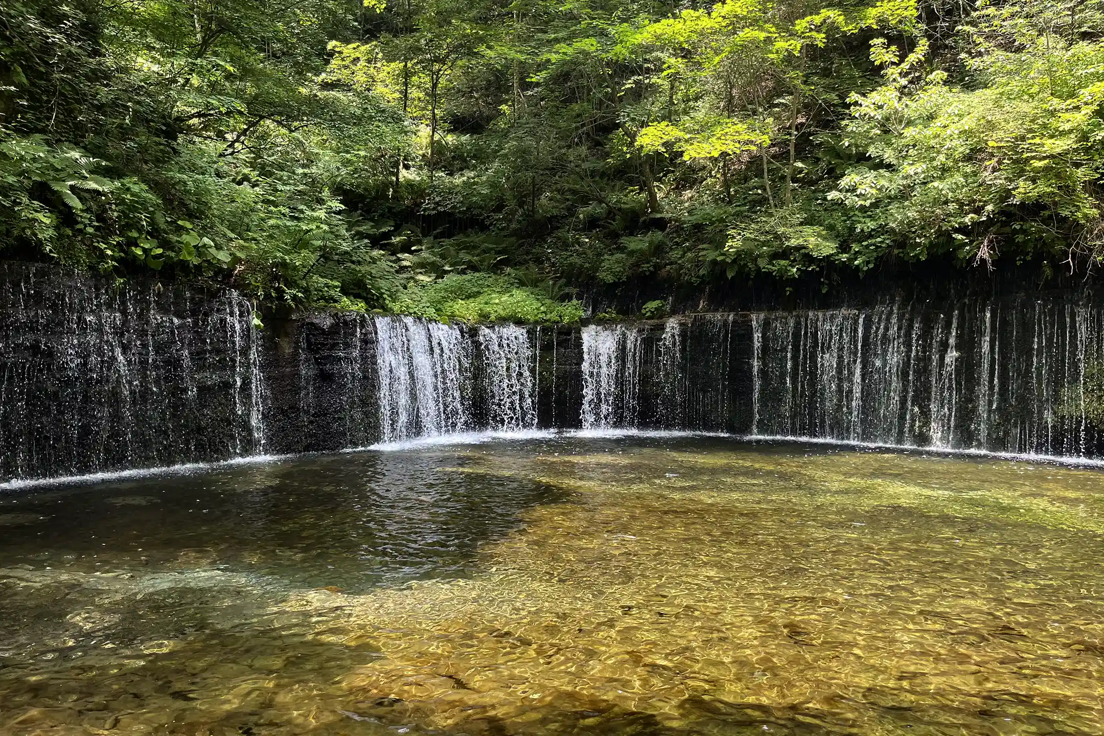
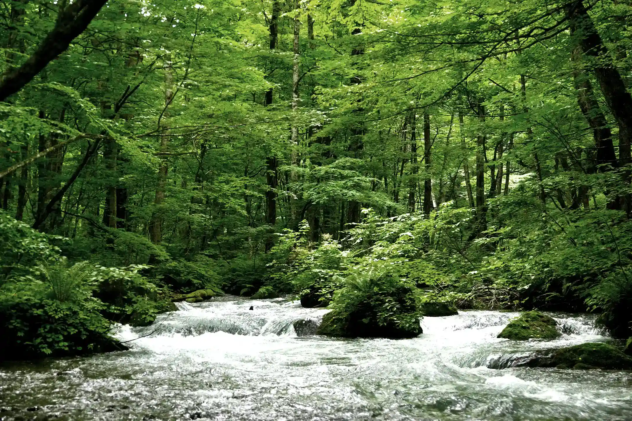
Oirase Gorge is a stream of about 14 kilometers in Aomori Prefecture that leaves Lake Towada at Nenokuchi and runs down through riverside forest to Yakeyama, past waterfalls, rapids and moss-covered rock. It is protected as a national Special Place of Scenic Beauty and Natural Monument, and it sits inside Towada-Hachimantai National Park. It is also, less famously, a managed water supply. The lake's outflow passes through a control gate, and how much water runs down the gorge is a figure the prefecture watches.
This guide covers the highlights, the trail, the best time to visit and the buses, and adds three things that are easy to miss: why a lake this large had no edible fish until 1905, where the stream's water goes after it leaves the gorge, and when the autumn color actually peaks. If you are planning around rest more than sightseeing, our companion piece on wellness at Oirase Gorge treats the stream as a retreat. This one is about how to read it.
What Is Oirase Gorge? A Mountain Stream With a Gate at Its Head
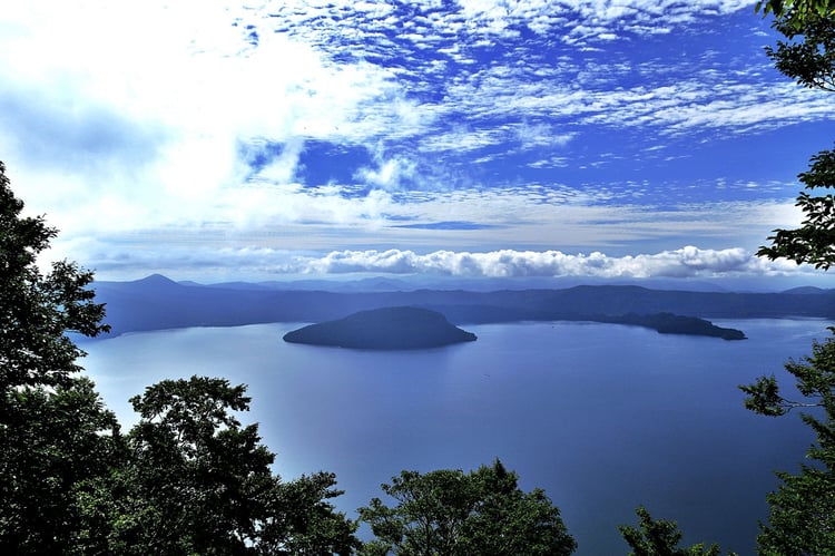
Start with the lake. Aomori Prefecture's cultural properties office describes Lake Towada, on the border between Aomori and Akita, as a double caldera lake, and Oirase as the stream of about 14 kilometers that flows out of it, with rapids, deep pools, waterfalls large and small, and a riverside forest that includes Japanese horse chestnut. The lake and the stream are listed together. They were designated a Place of Scenic Beauty and Natural Monument on 12 April 1928 and raised to Special Place of Scenic Beauty and Natural Monument on 29 March 1952, and the protected area reaches across the border into Kosaka in Akita as well as Towada City in Aomori. (If the word "prefecture" is new to you, our guide to what a prefecture is in Japan explains how the 47 work.)
The national park came between those two dates. Japan's tourism agency notes that the northern section of Towada-Hachimantai, with Lake Towada, Oirase Gorge and the Hakkoda Mountains, was designated a national park in 1936, and that the Hachimantai section to the south joined in 1956. The stream was protected for its scenery before it was a park, and that scenery depends on the lake behind it. Several of the facts below follow from that relationship.
How Much Water Oirase Gets, and Who Decides
It is easy to think of Oirase as untouched nature. Its flow is managed. In a July 2025 notice, Aomori Prefecture explained that Lake Towada's water flows from the Nenokuchi control gate into Oirase Gorge and is used for purposes including irrigation and tourism releases. That summer, after little rain since June, the lake level fell, and from 24 July the prescribed release into the gorge could not be maintained. The prefecture said it would share lake-level information with the water users and ask them to cooperate in saving water.
The prescribed figure appears in an August 2021 notice on the third meeting that year, held in writing after a dry summer, of the drought liaison council for the Oirase River system. The council exists, the notice says, so that water users can exchange information during a drought, use the water rationally and preserve the scenery. That third meeting came once August rain had raised the lake and the release from the Nenokuchi control gate had recovered to the prescribed daytime release of 5.2 cubic meters per second.
American readers have seen this arrangement before, at a far larger scale. Under the 1950 Niagara Treaty, as the International Joint Commission explains, the United States and Canada set minimum flows over Niagara Falls "for scenic purposes": 2,832 cubic meters per second by day in the tourist season and 1,416 at other times, with water above those minimums available for hydropower. Oirase's prescribed daytime release is more than 500 times smaller than Niagara's daytime minimum, and the uses Aomori names for Lake Towada's water include irrigation and tourism releases. Yet in both places a famous view runs on measured water, and a public body has decided how much of that water the view should get.
For a visitor this has one practical consequence. In a dry summer the falls you came to see can carry less water than they do in the photographs, and the reason lies upstream, at the gate.
Choshi Otaki and the Lake That Had No Edible Fish
The first large waterfall below the lake explains a second fact about it. The tourism agency's text on Lake Towada notes that the only exit from the lake is the Oirase River, and that a high waterfall on it prevents fish from reaching the lake from downstream. That waterfall is Choshi Otaki, about 7 meters high and 20 meters wide and known as the fish-blocking waterfall, according to a listing supervised by the Lake Towada National Park Association.
The result, in the agency's account of himemasu, was a lake with no edible fish. The change came from one man. Wainai Sadayuki (1858–1922) wanted local people to be able to eat fresh fish. Himemasu, a landlocked form of sockeye salmon native to Lake Akan in Hokkaido, had been moved successfully to Lake Shikotsu in 1895, and Wainai followed that example: he brought fish from Shikotsu, and in 1905 he succeeded in breeding himemasu in Lake Towada. The himemasu on lakeside menus today descends from that experiment. Standing at Choshi Otaki, you are looking at the barrier the whole story turned on.
Where Oirase Water Goes Next: The Inaoi Canal and Towada City
Below Yakeyama the gorge ends, but the water keeps working, and irrigation on the Oirase River has a founding story. According to the Tohoku Regional Agricultural Administration Office, Nitobe Tsuto (1793–1871) drew up a plan at the age of 60 to reclaim Sanbongi-hara, a barren upland around what is now Towada City whose name, "three trees," is said to record how few trees grew on it. Work began in 1855. With his son Jujiro (1820–1867), he dug a tunnel of 4.1 kilometers to take water from the upper Oirase River, and after five years of work the water reached the plateau in 1859, in the fifth month of the old lunar calendar. The main channel, the Inaoi River, ran about 10.3 kilometers and was later extended to about 39 kilometers, all the way to the Pacific.
The same office notes that a town was planned on the newly watered land, laid out as a grid about 1.3 kilometers square. This is the turning point in Oirase's history: one body of water came to do two jobs. Above Yakeyama it is scenery, protected by the 1928 and 1952 designations. Downstream it is the head of an irrigation system cut in the 1850s that made a planned town possible. The drought council exists so that the water users and the scenery can share the same lake in a dry summer.
Towada City has since had to reinvent its center. Its main avenue, Kanchogai, the "street of government offices," had grown noticeably desolate through population decline and the departure of offices, according to Towada Art Center, and in 2008 the city began a project called Arts Towada, placing artworks along the avenue to bring it back to life. The center itself, designed by the architect Ryue Nishizawa, holds 41 permanent works commissioned from 36 artists, Yayoi Kusama among them. A morning in the gorge and an afternoon on that avenue make a short day that covers the whole arc: the water, the town it made possible, and what the town did when its center began to empty.
Oirase Gorge Highlights: Falls (Taki) and Currents (Nagare)
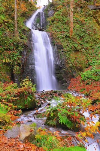
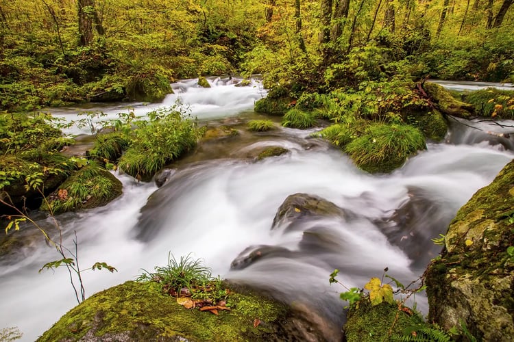
The quickest way to learn the gorge is by its bus stops, because most of them are named for what you get off to see. Heading downstream from the lake, JR Bus Tohoku's timetable lists Nenokuchi, Choshi Otaki, Kumoi-no-Nagare, Kumoi-no-Taki, Mamon-iwa, Ishigedo, Shimeikei, the Oirase Keiryukan visitor center and Oirase Keiryu Onsen. Kumoi-no-Taki is the waterfall in the photograph above, taken in late autumn.
The names are also a reading key. Taki is a waterfall, so Choshi Otaki and Kumoi-no-Taki are places where water drops. Nagare means a current, a stretch where the stream itself is the subject, braiding between rocks. Iwa is a rock and kei a gorge, so Mamon-iwa and Shimeikei name features of stone. If your time is short, decide first whether you want falling water or moving water, and the stop names will tell you where to get off. Of the currents, Japan's national parks guide singles out two as particularly impressive: Samidare-no-Nagare and Ashura-no-Nagare.
Of the falls, give Choshi Otaki a few minutes more than the others. It is the one with a history attached: a waterfall that once kept a whole lake empty of edible fish.
Reading the Moss at Oirase Stream
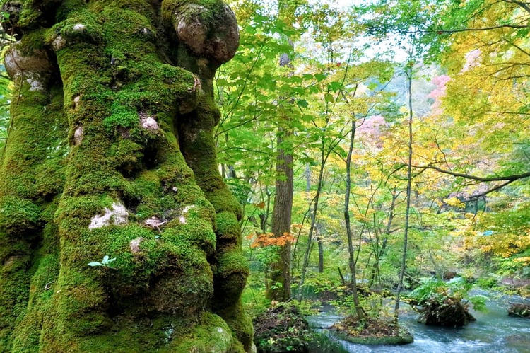
Moss is the second reason people come. Hoshino Resorts, which runs a hotel on the stream, says in its area guide that more than 300 species of moss have been identified along the Oirase Stream, and that the Bryophyte Society of Japan has selected the stream as one of "Japan's precious moss forests." The species count comes from the hotel's guide; we did not find the society's own list to check it against.
What you can do on your own is slow down. Three hundred species is a number no visitor can verify by eye, and walking the trail at a steady pace you will see green, not species. Stop at a single rock in the current or a single trunk on the bank and look closely for a minute, and the green separates into different textures and shades. Telling those apart by name is what a guided moss walk, described below, is for.
Walking the Oirase Gorge Trail: Distance, Time and Where to Start
The full trail runs 14.3 kilometers from Yakeyama to Nenokuchi, with a walking time of about five hours, according to the national parks guide, which notes that the gorge can also be explored by rental bike or by the bus on the road that runs parallel to the trail. That parallel road is what makes a partial walk easy: ride the bus to one stop, walk to another, and ride back. The guide lists the route upstream, from Yakeyama toward the lake, which means Choshi Otaki, near Nenokuchi, comes at the end of the walk. If you have only part of a day, the bus stop order gives you a shorter version: from Ishigedo upstream, the stops run Mamon-iwa, Kumoi-no-Taki, Kumoi-no-Nagare and Choshi Otaki, so a walk between Ishigedo and Choshi Otaki passes both kinds of water, falling and moving.
The natural starting point is the Oirase Keiryukan visitor center near Yakeyama, which English materials also call the Oirase Stream Museum. The national parks guide says it provides information on the area and its plants and animals and rents bicycles. Aomori Prefecture's tourism site lists it as open 9:00 to 16:00 with free admission, with light meals and souvenirs, and gives bicycle rental hours of 9:00 to 16:30, at 1,000 yen for a regular bicycle or 2,000 yen for an electric one for four hours, rented at the visitor center, the Ishigedo rest area and the JR Bus office at Nenokuchi. Pick up drinks and use the restroom there before you start.
Best Time to Visit Oirase Gorge
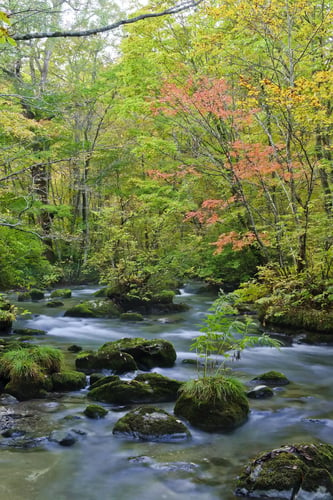
The prefecture's description of the protected site singles out two seasons as especially beautiful: fresh spring green and autumn color. For autumn, the dates matter. Aomori Prefecture's tourism site says the leaves begin to turn in October and peak every year around the end of October into the beginning of November. That is later than an earlier version of this article said; it put the peak in mid-to-late October. Arrive in mid-October and you will likely see the change beginning; for full color, aim for the last days of October or the first days of November.
The authorities' calendar points the same way. The private-car restriction described below ran from 27 October to 2 November in 2025, the week the local tourism organization chose for managing congestion.
The Autumn Car Restriction and the Winter Bus Gap
During the peak, the road beside the stream closes to private cars for part of each day. For 2025, the Towada-Oirase Tourism Organization announced a restriction from 27 October to 2 November, from 10:00 to 16:00 on weekdays and 9:00 to 16:00 on weekends, on about 10 kilometers of National Route 102 between the Sobe intersection and the Nenokuchi intersection. A shuttle bus ran between the Oirase Keiryu Onsen Ski Resort parking lot and the Yasumiya parking lot, and drivers passing through were directed to the Oirase Bypass. The stated purpose was to protect the natural environment and reduce congestion. Dates for 2026 should be confirmed on that site before you plan a drive.
Winter is quieter, and the difficulty is getting there. JR Bus Tohoku's timetable shows its regular runs to the gorge ending in mid-November in 2026, between 11 and 17 November depending on the service, and states that from 12 November 2026 to 31 March 2027 its Hakkoda service from Aomori runs only as far as Sukayu Onsen and does not continue to Oirase Gorge or Lake Towada. Aomori Prefecture's tourism site puts the general rule in one line: JR Bus service is suspended for the winter between mid-November and mid-April. Without a car, a winter visit needs planning well beyond the bus timetable.
Getting to Oirase Gorge by Bus From Hachinohe or Aomori
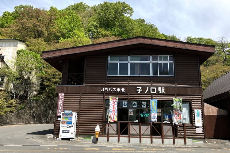
Two JR Bus Tohoku routes serve the gorge, and the station building at Nenokuchi, shown above with its rental-bicycle sign and souvenir counter, is where both meet the lake. Hachinohe and Shin-Aomori are both stops on the Tohoku Shinkansen. The Oirase service runs from Hachinohe. On the 2026 timetable, a bus leaving the West Exit of Hachinohe Station at 10:00 reaches Oirase Keiryu Onsen at the bottom of the gorge at 11:32, Nenokuchi at 12:05 and Lake Towada (Yasumiya) at 12:20; boarding this service at Hachinohe requires an advance reservation. The Mizuumi service runs from Aomori and Shin-Aomori stations through the Hakkoda Mountains; on the same timetable, a bus leaving Aomori Station at 7:30 reaches Lake Towada at 10:15, and the timetable marks this route as not requiring reservations.
For a gorge walk, get off at Oirase Keiryu Onsen or the Oirase Keiryukan stop at the bottom, walk upstream as far as your legs allow, and pick up a later bus at one of the stops along the road. Check the times of the later buses before you set off, since the timetable has only a handful of runs, and confirm the current timetable on JR Bus Tohoku's site, which lists both routes on one page.
Where to Stay and Eat Around Oirase and Lake Towada
Staying beside the stream is what makes the quiet hours possible: the early morning before the first bus arrives and the evening after the last one leaves. Hoshino Resorts runs a hotel on the stream, Oirase Keiryu Hotel, whose area guide is cited above. For choosing among inns more generally, our guide to choosing a ryokan sets out what separates a good one from an expensive one.
Eat with the history in mind. Himemasu is the fish to order at the lake: it is there because of Wainai's 1905 success. A 2018 Hoshino Resorts guide to lunch in Towada and Oirase names "Towada-ko himemasu" as a local brand and recommends one café's pasta made with himemasu confit. The same guide describes Towada as a place where soil building and vegetable growing thrive, and points to menus built around its burdock and nagaimo yam, grown in the city whose plateau the Inaoi canal first watered. On the road out of the gorge, the roadside station Oirase Roman Park, according to Aomori Prefecture's tourism site, brings together OIRASE BEER Brewery and Restaurant and Miraku Kobo, a local homemade-food factory, where you can find craft beer, pizza and soft-serve made with local raw milk; the brewery restaurant is listed as open 11:00 to 17:00 and closed on Wednesdays.
Three Levels of Access at Oirase
Everything in this guide sits at one of three levels of access. The first is open to anyone: the trail, the falls and the visitor center are free, and the buses along the road run to a timetable.
The second is open to anyone who knows when to look. Full autumn color arrives around the turn of October into November, in the same week the road closes to private cars. In a dry summer the stream can run below its prescribed release. After mid-November the buses stop running into the gorge. Choshi Otaki is a story about fish as much as a waterfall. None of this is hidden, but all of it is easy to miss.
The third level needs a guide. Hoshino Resorts' area guide lists an Oirase moss walk available from mid-April to early November, lasting one and a half or three hours, for groups of up to five or six people. Moss is the clearest case on the stream of something you can walk past for five hours without seeing; with someone who can name what is on a single rock, the same five hours become a different walk. If you are weighing Oirase against other northern nature trips, our guide to summer nature travel in Hokkaido covers the island across the strait.